Report on Roland Park's Sunday Streets pilot: 25 October 2009


26 November 2009


Report on the 25 October 2009 Roland Avenue Sunday Streets pilot

Prepared by

Mike McQuestion, co-Chair, Sustainability Initiative (mike.mcquestion@gmail.com)

Phil Spevak, President (pjspevak@gmail.com)


Roland Park Civic League


Background

Through its Sunday Streets Program, the City of Baltimore proposes to close off selected streets to motorized traffic during Sunday mornings, making them available for recreational use. Sunday Streets is modeled on Bogota, Colombia’s ciclovia. Every Sunday, from 8AM until 1PM, a network of normally busy Bogota streets is closed to motorists, allowing up to 1.7m residents to traverse the city on bicycles, rollerblades, skateboards or on foot. Bogota’s ciclovia has operated weekly since the early 1980s, providing residents in 70% of the city’s neighborhoods with easily accessible recreational opportunities. The idea is catching on. European examples include Copenhagen and Paris. In Switzerland’s Slow Up Program, 35-50km segments of particularly scenic roads are closed on consecutive Sundays during the summer months for pedestrians, skaters and cyclists to use. At this writing, 38 cities in eleven countries have organized ciclovias. Routes range from 1 to 121 km in length. Duration of ciclovia events ranges from 2 to 12 hours. The number of events ranges from 18 to 64 per year. Annual budgets range from US$45k to US$2.08m. In Seattle WA, Cambridge MA, San Francisco CA and El Paso TX, ciclovias happen at least every month during the cycling season. Ciclovia programs are credited with improving physical fitness, engaging young people in constructive social activities and increasing neighborhood cohesiveness (Sarmiento et al 2008).

Sunday Streets is an integral part of Baltimore’s 2009 Sustainability Plan.

The City’s street network is particularly conducive to Sunday Streets. (For more on this, see Baltimore’s 2006 Master Bicycle Plan.

City planners prepared a detailed Sunday Streets implementation plan nearly three years ago. The plan identifies specific streets and outlines logistic and security procedures for the Police and Transportation Department to follow. However, it has never been implemented, ostensibly for budgetary reasons.

Supporters of Baltimore’s Sunday Streets Program include the local bicycling advocacy group One Less Car. In 2008, One Less Car developed a 5-mile Sunday Streets pilot route which runs from Lake Montebello to Druid Hill Park along 33rd Street. This “lake-to-lake” pilot, proposed for August 2008, was not implemented, again for budgetary reasons (see below).

On October 25, 2009, a modest, one-mile long Sunday Streets pilot was carried out successfully on Roland Avenue, sponsored by the Roland Park Civic League. Details of that experience are described below. Most notably, the activity was successfully executed from plan to completion in 8 weeks.


Continue Reading

  • Currently 0.00/5
Rating: 0.00/5 (0 votes cast)

Submit your bike data to Google


Google told us last month that they were working on bike directions, but they didn’t make a big deal out of telling us how to help. Well, I could be mistaken, but it looks like the offer to ‘partner’ on bike directions (and all sorts of ‘mappy’ features) is just sitting there, waiting for folks to get to it.

If you speak ‘nerd’, or know someone who does, then the rest of this could apply to you. There are some high-level FAQs about data formats, and a link to a form to fill-out if you have some data and you want to partner with Google to get your data integrated into Google Maps. The data we most care about here, of course, is bike-related data — bike lanes, routes, paths, etc.

Who has bike data? Well, cities and bicycle coalitions, probably — and/or the folks who hold the copyrights on maps/data, if they are copyrighted. [Of course you know how we feel about this type of data -- it should be free free free.]

If you are a planner/GIS-type person in the Bicycle division of the San Francisco Municipal Transportation Agency, then maybe you can help Google get us some bike directions — just fill out the form and see what happens. Could the good folks of our local bike coalition (the folks who put out the bike map) possibly work with Google to get this done? Got me — there’s one way to find out. [SFBC is up to 11,000+ members, now.]

Whatever city or town you live in, do your best to convince someone — I’d start with your local walk/bike/transit advocacy organization, if you have one — to contact the city/town/municipal government and ask them to follow up on this.

What does bike data look like? A lot of it is over my head, but we can look at Google’s “Complete Map Content Specifications“. There are lots of details, of course, but the human-understandable parts are very cool. If you’ve wondered what the GTFS format for bikes was going to be, we may have our first draft.

Can the data format handle wide curbs vs. bike lanes vs. one-ways vs. two-ways vs. high-speed arterials vs. bike boulevards vs. contraflow lanes vs. buffered bike lanes? I’m not sure, but it looks like it’s pretty flexible and can handle most if not all of the crazy configurations and complexities that occur in road networks.

Continue Reading

  • Currently 0.00/5
Rating: 0.00/5 (0 votes cast)

RESOURCES from the National Center for Bicycling & Walking


-> "STATE HIGHWAYS AS MAIN STREETS: A STUDY OF..."
"...Community Design and Visioning;" WSDOT Research Report; by Nichols, Payne, Gear, and Miller; Washington State Dept. of Transportation, Office of Research & Library Services. Oct. 2009 (general info and link to 895kb pdf)
http://tinyurl.com/yjs4u55

-> "TRAVEL DEMAND IN THE CONTEXT OF GROWING DIVERSITY..."
"...Considerations for Policy, Planning, and Forecasting;" by Heather Contrino and Nancy McGuckin; TR News 264 Sept-Oct 2009. (general info and link to 741kb pdf)
http://tinyurl.com/yjrf3tu

-> "REALIZING THE POTENTIAL FOR SUSTAINABLE AND EQUITABLE..."
"...T.O.D.: Recommendations to the Interagency Partnership on Sustainable Communities;" a Policy White Paper by Reconnecting America. November 18, 2009 (473kb pdf)
http://tinyurl.com/ydmvatz

-> "MAKING THE LINK FROM TRANSPORTATION TO PHYSICAL..."
"...Activity and Obesity;" by Daniel A. Rodriguez, Univ. of North Carolina, Chapel Hill. Summer 2009 (563kb pdf)
http://tinyurl.com/y926bcj

Continue Reading

  • Currently 0.00/5
Rating: 0.00/5 (0 votes cast)

ROAD DESIGN AND DRIVERS’ SPEED CHOICES


"This report describes an investigation into whether or not physical characteristics of the roadway and the roadside environment are associated with actual vehicle running speeds, and how actual vehicle running speeds are associated with the occurrence and severity of motor vehicle crashes in conjunction with other roadway and roadside characteristics.

"Actual vehicle running speeds were observed at about 300 locations in urban, suburban and rural areas across Connecticut, at locations without horizontal curves or traffic control devices. Only vehicles traveling through the section unimpeded either by leading or turning vehicles were observed in order to get true free flow traffic speeds. Roadway and roadside characteristics were observed, and statistical prediction models were estimated to learn more about how free flow vehicle speed, roadway and roadside characteristics and crash incidence and severity are related. The factors associated with higher average running speeds are wide shoulders, large building setbacks and a residential location.

"The factors associated with lower average running speeds are on-street parking, sidewalks and a downtown or commercial location. These findings suggest that drivers slow down where the road feels 'hemmed-in' or there is noticeable street activity, and they speed up where the road feels 'wide open' or street activity is less noticeable. This finding is not surprising, but these relationships are quite strong in the observed data, and it is a useful result to isolate this short list of factors that are significantly correlated with actual vehicle running speeds.

"These findings demonstrate that through careful, intentional selection of roadway and roadside design elements, it is possible to influence the running speed of traffic on a road. It appears that drivers indeed take cues from elements of the roadway and roadside environment to decide how fast to drive and these cues are independent of the posted speed limit and other considerations that might be important to the community for reducing speeds.

"So the good news is that it is possible to influence drivers' choice of speed through design of roadway and roadside elements; but the bad news is that many existing roads cue drivers to travel much faster than the posted speed limit and the community would like."

Continue Reading

  • Currently 0.00/5
Rating: 0.00/5 (0 votes cast)

Report, petition call for safer roadway planning


From the Fast Lane: The Official Blog of the U.S. Secretary of Transportation

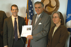
Last week, our friends at Transportation For America and the Surface Transportation Policy Partnership released a valuable report called Dangerous By Design. Yesterday I met with James Corless of t4America and a few of his colleagues from other interest groups about this report and its conclusions.

Corless and friends
Now, "Dangerous By Design" has turned a lot of heads and for good reason. It shows that 11.8% of all traffic fatalities in America are pedestrians.

In the meeting Look, no amount of engineering to make the insides of our vehicles safer for occupants is going to protect pedestrians and bicyclists. We need safer roadways. We need roadways designed to account for the needs of everyone who uses them, whether driving, walking, or riding in a wheelchair or on a bicycle.

The great thing about this Complete Streets approach to road planning is that it's actually cheaper to plan for multiple road uses ahead of time than to retrofit roadways after they are built and someone gets injured or killed.

The problem with this approach is that it does cost a little extra up front. And states and communities facing budget shortfalls may be tempted to let road safety features--wide sidewalks, safe crosswalks--get cut along the way.

The petition seeking my leadership had over 4,100 signatures! That's why the groups I met with yesterday are asking for federal leadership. And that's where this DOT comes in. It turns out that a complete streets approach offers the perfect intersection of my twin guideposts: safety and livable communities.

But, as much leadership as DOT can offer, only Congress can authorize federal funding for such programs. And, as the petition urging my leadership on safer roadway planning reminds us:

"The Transportation Bill comes around just once every six years, and we can’t afford another six-year delay on building the 21st Century transportation system our country craves."

That's why, when we hold our upcoming open meetings on new transportation legislation, I urge all of you who care about this important issue--from experts to everyday pedestrians--to come forward and tell us how strongly you feel about this. Then, we can let Congress know how much momentum is truly behind safer road planning.

So please stay tuned as we announce the dates and locations of these meetings and please visit the websites of the organizations who visited me yesterday (I've listed them below) to see what you can do to raise your voice on this important issue.

Continue Reading

  • Currently 0.00/5
Rating: 0.00/5 (0 votes cast)

Traffic Injustice


This is the First of a Two Part Story

By Bob Mionske
Susanne Kibler-Hacker, 42, a highly experienced cyclist, is the coordinator for New Hampshire’s ride-to-work days at her office. The morning of October 15, 2009, she was riding her bike to work. She never arrived. She was wearing a reflective fluorescent vest, but a driver still hit her from behind. Kibler-Hacker, who survived the collision, was listed in serious condition at Dartmouth-Hitch*censored* Medical Center. Although New Hampshire has the best safe passing law in the nation, the driver was not cited for violating that law, or any other. Instead, police issued the driver a warning to exercise due care.

Continue Reading

  • Currently 0.00/5
Rating: 0.00/5 (0 votes cast)

Will Complete Streets legislation get run over?


Transportation For America November 2009
Act Now
Will Complete Streets legislation get run over?

With more than 400 pedestrians killed every month in America, the desperate need for safe, "Complete Streets" in our communities is abundantly clear. In response to your emails and our advocacy, the Obama Administration is taking notice of the pedestrian safety crisis (see below), but many in Congress have yet to make a stand on the issue.

We need to demand safer streets from leaders in Washington. New roads should be built for all the people who use our streets - motorists, pedestrians, and cyclists - of every age and ability. Help make safer streets the law: Ask your representatives and senators to get vocal in support of the Complete Streets Act of 2009.

Make a difference today.
Take Action
News
Florida County Heeds Call for Complete Streets
Florida County Heeds Call for Complete Streets | 11/13/09

The day after our Dangerous by Design report ranked Florida metros among the worst for safety, Lee County, FL, adopted a Complete Streets resolution...

Senators Look to Transit to Revitalize Rural America
Senators Look to Transit to Revitalize Rural America | 11/13/09

Senators in some rural states are leading the charge in the Senate to explore how transportation innovation can reap big rewards for rural Americans...

John Robert Smith
VIDEO: "Or we'll lose it for my grandson's generation." | 11/09/09

In this video interview, Mayor John Robert Smith, new co-chair of Transportation for America, speaks about the fight for real transportation reform...

Updates
You Got USDOT Secretary Ray LaHood on Board!

Last week we met with US Transportation Secretary Ray LaHood, presenting him with the signatures of thousands of Americans demanding safer streets and our Dangerous by Design report, exposing the crisis of pedestrian safety in America.

The stark statistics left an impression. "The right of way doesn't just belong to cars," he said. "It belongs to pedestrians and bicyclists as well."

Secretary LaHood was hopeful that federal transportation policy can better accommodate all users and keep them safe, and that now is the right time to make that change. He even blogged about the meeting afterwards on the US Department of Transportation's official blog.

See photos from the meeting and read more about what Secretary LaHood had to say.

Learn More
FAST FACTS

Each month, on average, more than 400 pedestrians are killed in America - that's roughly the equivalent of a jumbo jet crashing every single month.

Source: Transportation for America, "Dangerous by Design."

PARTNER SPOTLIGHT: 400 and counting!
Amtrak Partnership for Prevention Metro Atlanta Chamber of Commerce Minnesota AFL CIO
 Flickr Facebook Blog Twitter Twitter

Were you forwarded this email? Subscribe for updates from Transportation for America here.

Transportation For America || info@t4america.org || 1707 L Street NW #250 Washington, DC 20036

  • Currently 0.00/5
Rating: 0.00/5 (0 votes cast)

Yes! Friday Morning Ride


Folks!

Meet in front of City Hall by 9:00 AM this Friday, for a ride to Droodle… that’s up thru Bolton Hill, Druid Hill Lake and Park, the Jones Falls Trail, then back Clipper Mill and Falls Roads. (That’ll trim the cookin’ off ya’s.)
  • Currently 0.00/5
Rating: 0.00/5 (0 votes cast)

2nd Annual 'Bob Moore Memorial Ride' Bob's favorite Thanksgiving Day ride


From the Baltimore Bicycling Club:

all pace short - 9:30 am - 25 mi - Diane Purpura
START: GSS Greenspring Station

2nd Annual 'Bob Moore Memorial Ride' Bob's favorite Thanksgiving Day ride - mod. hilly w/ rest stop@St. John's Episcopal Church - where you can view the outdoor ceremonial 'blessing of the hounds' prior to the start of a real fox hunt. (Note: later start time than last year.) No food stop on route; bring sufficient drinks/snacks.
  • Currently 0.00/5
Rating: 0.00/5 (0 votes cast)